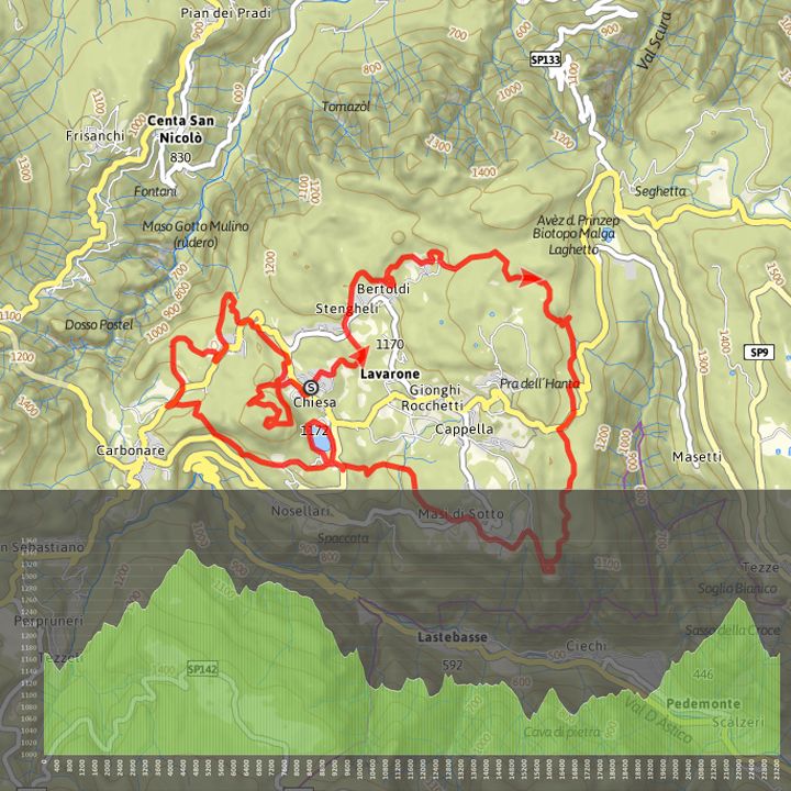
The ring-trail of the 100 KM dei Forti in the Lavarone area reaches some interesting sites such as the Slaghenaufi Military cemetery (1240 m), the Tablat plateau (1345 m), the Gschwent-Belvedere Fortress (1170 m), Lake Lavarone and the Austrian Military Command next to Virti. The trail is on dirt road and varies along easy stretches and tough ascents and technical descents with different difficulty.Difficulty: ChallengingDuration: 3,28 hoursLenght: 23,6 kmMaximum altitudine: 1367 mDifference in height: 739 mDifference in descent: 717 mLenght for E-Bike: BreveCircular route PDF GPX for more information visti bikehotels.alpecimbra.it

")