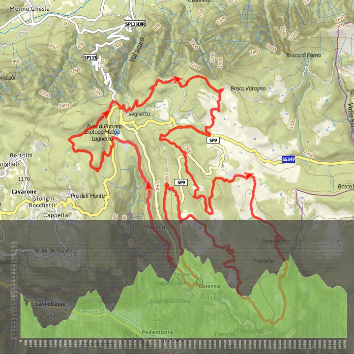
The trail is a section of the 100 km dei Forti in the Lusérn area, is varying, exciting and tough. From the centre of Lusérn (1333 m) it descents to Malga Laghetto, ascents to the Tablat plateau (1350 m.), turns to Spiazzo Alto (1380 m), reaches Ponte alto (1460 m), descents to Passo Vezzena (1402 m), climbs Mount Cucco (1575 m), descents to Millegrobbe di Sopra (1430 m), goes to Costalta and through “il Basson” and the long road of Costesin back to Lusern passing by Forte Lusérn (1549 m) and Malga Millegrobbe di Sotto (1424 m). Difficulty: Challenging Duration: 5,59 hours Lenght: 39,3 km Maximum altitude: 1579 m Difference in height: 1107 m Difference in descent: 1120 m Lenght for E-Bike: Medium - needing to recharge Circular route PDF GPX for more detail visit bikehotels.alpecimbra.it

")